
Search Term Record
Metadata
Name |
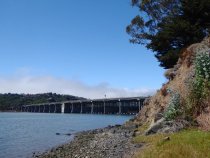
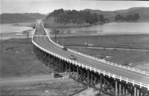
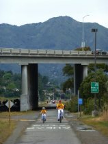
Richardson Bay Bridge |
Number of Archive records |
1 |
Number of Library records |
0 |
Related Records
-
-
-
-
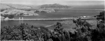
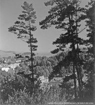
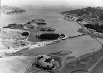
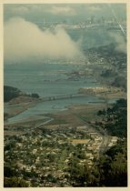
Aerial view with Richardson Bay Bridge in background, circa 1945 - Print, Photographic
MVU1899
Record Type: Photo
-
-
-
-

-
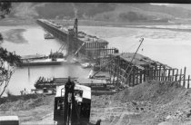
Constuction of the Richardson Bay Bridge, circa 1930's - Print, Photographic
2017.119.001
Record Type: Photo
-
-
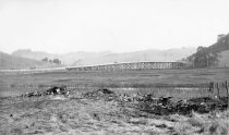
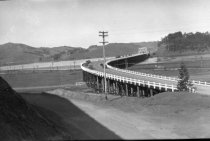
East Blithedale Trestle looking northerly, circa 1930s - Print, Photographic
2020.012.003
Record Type: Photo
-
East Blithedale Trestle looking southerly, circa 1931 - Print, Photographic
2020.012.004
Record Type: Photo
-
-
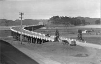
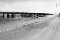
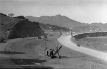
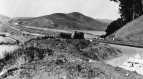
Highway 101 Richardson bay Bridge Redwood trestle, circa 1930's - Print, Photographic
2017.119.004
Record Type: Photo
-
Highway 101 Richardson bay Bridge Redwood trestle, circa 1930's - Print, Photographic
2017.119.005
Record Type: Photo
-
Highway 101 Richardson bay Bridge Redwood trestle, circa 1930's - Print, Photographic
2017.119.006
Record Type: Photo
-
Hwy101 Richardson Bay Bridge Redwood trestle at Sausalito ramp, circa 1930's - Print, Photographic
2017.119.007
Record Type: Photo
-
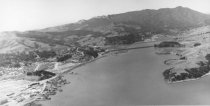
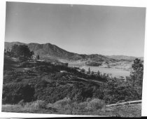
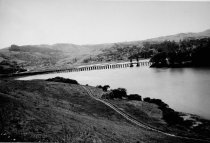
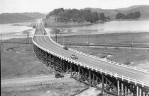
Marshlands and Richardson Bay Bridge, circa late 1930s - Print, Photographic
MVU1441
Record Type: Photo
-
Marshlands looking west from the Richardson Bay Bridge, late 1930s - Print, Photographic
MVU1438
Record Type: Photo
-
-
-
-
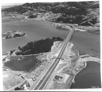
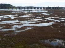
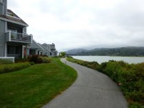
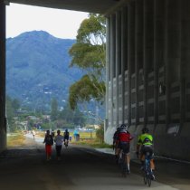
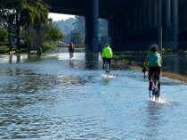
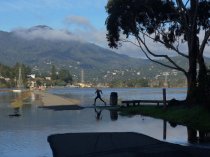
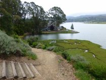
Multiuse Pathway bike riders during king tide, 2012 - Image, Digital
2016.015.006
Record Type: Photo
-
-
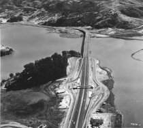
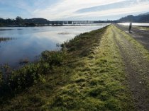
Multiuse Pathway jogger navagating the king tide, 2016 - Image, Digital
2016.015.389
Record Type: Photo
-
-
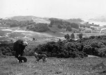
Nellie Armager with cocker spaniels standing at site of Enchanted Knolls, 1945 - Print, Photographic
2011.008.001
Record Type: Photo
-

-
Oral History of Charles Crawford - Oral History
Born on June 16th, 1928, in the San Francisco Presidio, Charles "Chuck" Crawford spent the first 13 years of his life in the bustling Outer Mission neighborhood of San Francisco. On the weekends, his family would take the ferry, and then later the brand new Golden Gate Bridge, to visit his maternal grandparents in Mill Valley. During these trips, his parents fell in love with the town and decided to move up north. After settling in Mill Valley, C...
Record Type: Archive

-
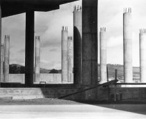
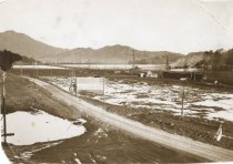
Paving & constuction of the Richardson Bay Bridge, circa 1930's - Print, Photographic
2017.119.002
Record Type: Photo
-
-
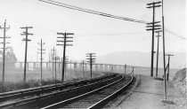
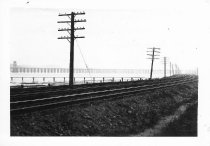
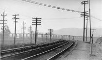
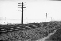
Railroad commuter train line, telephone poles, Richardson Bay Bridge, circa 1930's - Print, Photographic
2017.119.010
Record Type: Photo
-
Railroad commuter train line, telephone poles, Richardson Bay Bridge, circa 1930's - Print, Photographic
2017.119.011
Record Type: Photo
-
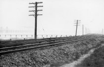
Railroad commuter train line, telephone poles, Richardson Bay, circa 1930's - Print, Photographic
2017.119.009
Record Type: Photo
-
Railroad commuter train line, telephone poles, Richardson Bay, circa 1930's - Print, Photographic
2017.119.008
Record Type: Photo
-

-
-
-

-
-
-
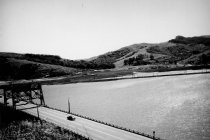
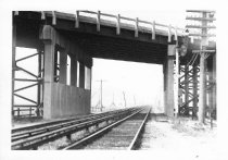
Richardson Bay Bridge beyond railroad tracks, circa 1930s - Print, Photographic
2020.012.001
Record Type: Photo
-
-
-

-
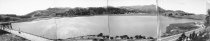
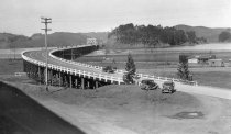
Richardson Bay Bridge completed looking east, circa 1930s - Print, Photographic
2020.012.009
Record Type: Photo
-
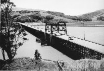
Richardson Bay Bridge completed with lift span looking east, circa 1930s - Print, Photographic
2020.012.010
Record Type: Photo
-
-

-