
Search Term Record
Metadata
Name |
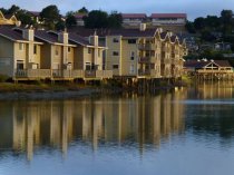
Richardson Bay |
Number of Archive records |
5 |
Number of Library records |
0 |
Related Records
-
-
-
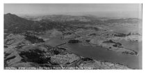
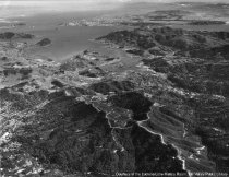
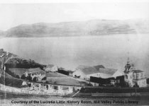
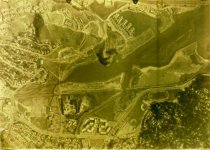
Aerial view of Mill Valley and environs, circa 1930s - Print, Photographic
MVU1097
Record Type: Photo
-
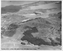
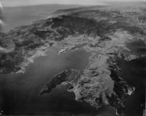
Aerial view of Mill Valley looking toward San Francisco, 1959 - Print, Photographic
MVU1750
Record Type: Photo
-
-
-
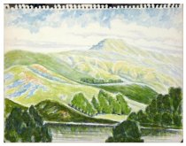
A watercolor painting of hills of Richardson Bay - This unframed watercolor was torn from a sketch book. It's a scenic view of tree-studded rolling hills. See notes on location.
unknown
Record Type: Object
-
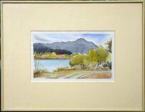
A watercolor view of Mt. Tamalpais looking across Richardson Bay - A framed watercolor showing view of Mount Tamalpais, looking across Richardson Bay from near the Shelter Bay apartment complex.
unknown
Record Type: Object
-
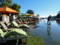
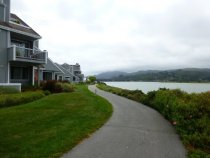
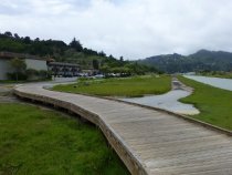
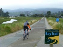
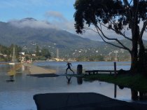
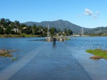
Bike rider on the Multiuse Pathway during king tide, 2012 - Image, Digital
2016.015.068
Record Type: Photo
-
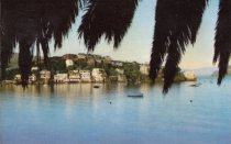
Corinthian Island - Postcards
Postcard shows photo of Corinthian Island (no longer extant) as seen from Belvedere Island. Used to be locaed across the Richardson Bay from Sausalito and was attached to Tiburon sometime in the 1980s.
Record Type: Archive
-
-
-
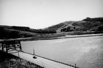
East Blithedale Trestle looking northerly, circa 1930s - Print, Photographic
2020.012.003
Record Type: Photo
-
East Blithedale Trestle looking southerly, circa 1931 - Print, Photographic
2020.012.004
Record Type: Photo
-
-
-
-
-
-
-
-
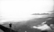
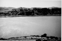
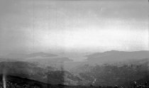
Fog filled Richardson Bay from East Peak Mt. Tamalpais, circa 1920. - Negative
2018.027.001.503
Record Type: Photo
-
-
-
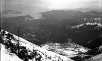
Looking toward San Francisco from snow-covered Mt. Tamalpais 1922 - negative
2018.027.001.517
Record Type: Photo
-
-
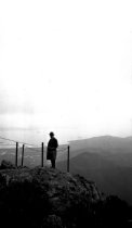
Man at viewpoint East Peak Mt. Tamalpais with Richardson Bay in background. - Negative
2018.027.001.505
Record Type: Photo
-
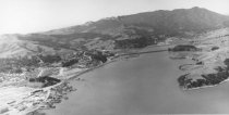
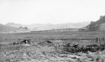
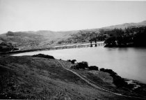
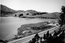
Marshlands and Richardson Bay Bridge, circa late 1930s - Print, Photographic
MVU1441
Record Type: Photo
-
-
-
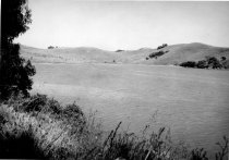
Marshlands looking west from the Richardson Bay Bridge, late 1930s - Print, Photographic
MVU1438
Record Type: Photo
-
-
-
-
-
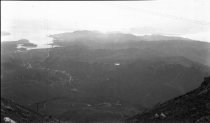
Mill Valley, Richardson Bay and Marin Headlands from Mt. Tamalpais - negative
2018.027.001.516
Record Type: Photo
-
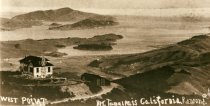
Mt. Tamalpais and The West Point Inn, 1906 Mt. Tamalpais and the West Point Inn, Dec. 29, 1906. - Print, Photographic
cmlpl_108
Record Type: Photo
-
-
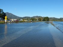
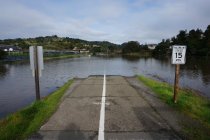
Multiuse Pathway and Miller Avenue inundated by king tide, 2012 - Image, Digital
2016.015.004
Record Type: Photo
-
-
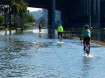
Multiuse Pathway bike riders during king tide, 2012 - Image, Digital
2016.015.006
Record Type: Photo
-
-
-
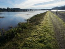
Multiuse Pathway jogger navagating the king tide, 2016 - Image, Digital
2016.015.389
Record Type: Photo
-
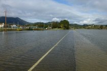
Multiuse Pathway near East Blithedale Avenue inundated by king tide, 2017 - Image, Digital
2016.015.441
Record Type: Photo
-
-
Multiuse Pathway near Tamalpais High School inundated by king tide, 2017 - Image, Digital
2016.015.442
Record Type: Photo
-
Multiuse Pathway photographer during king tide, 2012 - Image, Digital
2016.015.005
Record Type: Photo
-
Multiuse Pathway rest stop inundated by king tide, 2017 - Image, Digital
2016.015.445
Record Type: Photo
-
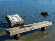
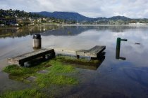
Multiuse Pathway signage and bench inundated by king tide, 2012 - Image, Digital
2016.015.846
Record Type: Photo