
Search Term Record
Metadata
Name |
Maps |
Number of Archive records |
26 |
Number of Library records |
0 |
Related Records
-
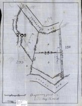
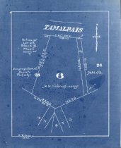
Argiewicz Purchase, 1924 - Maps
A map showing the Argiewicz Purchase, a piece of land between Lovell Avenue and Tamalpais Avenue, Mill Valley, California, 1924.
Record Type: Archive
-
-
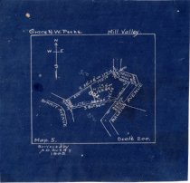
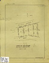
Grace N.W. Peeke. Mill Valley. Map. 5., 1905 - Maps
A blueprint map showing lots near Summit Avenue and Ralston Avenue, with latitudes and longitudes, 1905.
Record Type: Archive
-
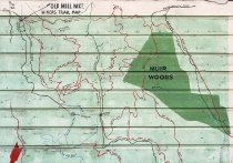
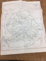
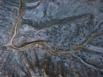
Hiker's guide trails and distances of Marin County, Calif. - Maps
Map showing trails in Marin County with major roads and towns. No scale schematic. Originally published in 1938, revised and redrawn by the Tamalpais Caonservation Club in September 1951, February 1970 and February 1973.
Record Type: Archive
-
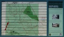
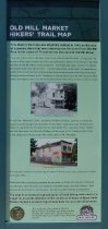
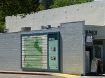
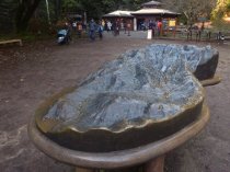
Hikers Trail Map from Old Mill Market new and old panels, 2019 - Image, Digital
2016.015.717
Record Type: Photo
-
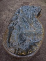
Hikers Trail Map from Old Mill Market new panel, 2019 - Image, Digital
2016.015.718
Record Type: Photo
-
Hikers Trail Map from Old Mill Market relocated, 2019 - Image, Digital
2016.015.716
Record Type: Photo
-
Land of Tom Rush: Mill Valley, Marin County, California, date unknown - Maps
A map showing a few land plots between Elinor Avenue and Edith Road, Mill Valley, California, date unknown
Record Type: Archive
-
Map #2 of Eastland and Millwood, Mill Valley, 1890's - Map No.2 by the Tamalpais Land and Water Company. It includes Eastwood & Millwood in Marin County, CA. Surveyed by O'Shaughnassy, C.E. 1889 with additions and modifications by L. H. Shorty (sp), 1891
circa 1900
Record Type: Object
-
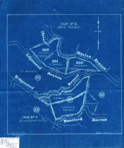
Map No. 5, Mill Valley and Map No. 7, Homestead Valley, 1905 - Maps
A map showing the lands purchased by F.T. Brazil and W.V. Stolte near Edgewood Avenue, Marion Avenue, and Ridgewood Avenue, Mill Valley, California, 1905.
Record Type: Archive
-
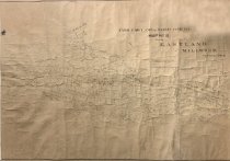
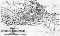
Map of Eastland, Millwood and Vicinity: A Subdivision of Old Mill Valley, date unknown - Maps
A photocopy of a map showing the areas that were called Eastland, Millwood near downtown Mill Valley, date unknown.
Record Type: Archive
-
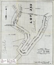
Map of Southerly Portion of Lot No. 359 of Tamalpais Land and Water Company Map 5, Marin County, 1914 - Maps
Tamalpais Land and Water Company Map No. 5, 1914. Map of southerly portion of Lot No. 359 near Thompson Avenue and Myrtle Avenue, Mill Valley, Calif.
Record Type: Archive
-
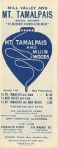
Mill Valley and Mt. Tamalpais Scenic Railway advertisement brochure, circa 1913 - Ephemera
Mill Valley and Mt. Tamalpais Scenic Railway advertisement brochure. Blue printing on white background, prices are listed on the front and back covers. Back panel also compares mileages and prices for eight other mountain railroads, proving that the Mount Tamalpais and Muir Woods Railway offers the best value. Five of the other eight mountain railroads are in Switzerland. Two panels on the same side of the sheet when folded out display a map of t...
Record Type: Archive
-
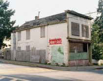
Mill Valley Historical Society members at Old Mill Market, 2004 - Print, Photographic
2014.018.003
Record Type: Photo

-
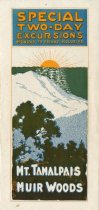
Mount Tamalpais and Muir Woods Special Two-Day Excursions brochure, circa 1918 - Ephemera
Two-page flyer printed on both sides, folded in half to create four pages. The inside is black and white with a photo of the railroad passenger gravity car and a narrative description of the major sights on Mount Tamalpais and in Muir Woods. The front cover has a multi-color drawing of the sun setting over the ocean beyond Mount Tamalpais and the trees in the foreground. At the top of the cover page is the following text: "Special Two Day Excursi...
Record Type: Archive
-
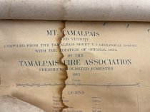
Mt. Tamalpais and vicinity - Maps
One map on cloth backing. Mt. Tamalpais and Vicinity Compiled from the Tamalpais Sheet U. S. geological survey with the addition of original data. Tamalpais Fire Association . Frederick E. Olmsted, Forrester 1915. The donor acquired the map in the mid 1970s and it was water damaged in 1982. It was donated in the memory of the dedicated members of the Mill Valley Fire Department.
Record Type: Archive
-
-
-
-
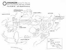
O'Hanlon Center for the Arts map, circa 2016 - Maps
A map of the O'Hanlon Center for the Arts. The map shows the locations of the Center's loft studios, artists' residences, ceramic studio, and gallery.
Record Type: Archive
-
-
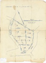
Portion of Lot 23, Block 6, Map 5, 1905 - Maps
A blueprint map showing a lot of land owned by M. M. O'Shaughnessy, located along Tamalpais Avenue and bordered on the west by property belonging to the Congregational Church, 1905.
Record Type: Archive
-
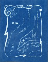
Portion of Lot 331, Map No. 5, Mill Valley Cal., 1905 - Maps
A blueprint map showing a portion of a lot near Marguerite Avenue, with latitudes and longitudes, 1905.
Record Type: Archive
-
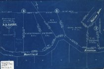
Portion of Map No. 7 Surveyed by A.D. Avery, 1906. Mill Valley, Calif. - Maps
A blueprint map showing the land plots near Montford Avenue and Molino, Mill Valley, California. Owners of plots noted on map.
Record Type: Archive
-
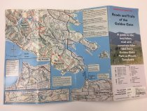
Roads and Trails of the Golden Gate - Maps
Roads and Trails of the Golden Gate. A guide to the best hikes, road and mountain bike rides from Golden Gate Park to Mount Tamalpais. Lists specific hikes and bike rides with desciptions and distances.
Record Type: Archive
-
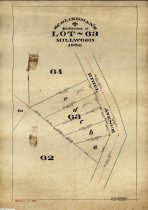
Schlingman's Subdivision of Lot 63 Millwood, 1906 - Maps
A map showing the subdivision of lot 63 Millwood off of Ethel Avenue, Mill Valley, California.
Record Type: Archive
-
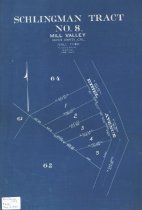
Schlingman Tract No. 8 Mill Valley, Marin County Calif., 1907 - Maps
A blueprint map showing the subdivision of Schlingman Tract No. 8 near Ethel Avenue, Mill Valley, California.
Record Type: Archive
-
-
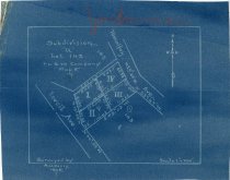
Subdivision "a", Lot 143. T.L. & W. Company Map 5., 1906 - Maps
A blueprint map showing lots between Tamalpais Avenue and Lovell Avenue, with latitudes and longitudes,1906.
Record Type: Archive
-
Subdivision of Lot 46. Tamalpias Land & Water Company, Map 5 - Maps
A map showing the subdivision of lot 46 near Wildomar Street and Molino Avenue, Mill Valley, Calif.
Record Type: Archive
-
Tamalpais Land and Water Company Mill Valley, 1905 - Maps
Tamalpais Land and Water Company Map, 1905. A map showing Blithedale Canyon with streets, land plots, and creeks, Mill Valley, Calif.
Record Type: Archive
-
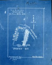
T.L. & W. Company Map No. 5. Portion Blk. 66, 1905 - Maps
A blueprint map showing lots between Ethel Avenue and Janes Street, with latitudes and longitudes, 1905.
Record Type: Archive
-
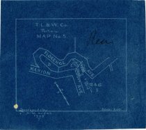
T.L & W. Co. Portion MAP No. 5., 1905 - Maps
A blueprint map showing lots between Marion Avenue and Florence Avenue. Includes latitudes and longitudes, 1905.
Record Type: Archive
-